
Finally Understand Why Some Acres Perform Better Than Others
Terrain brings precision intelligence by combining your land, water, and yield data, so you can see what’s happening across every acre and make smarter decisions.
Find Your Land. Scout New Land. Manage It All.
Most tools show various pieces of the puzzle. Our Ag data intelligence platform, TerrainIQ, puts every layer of your farm’s data on one interactive map, so you can quickly understand the land you own today, and the land you want tomorrow.
- Search and locate your current fields
- Overlay visual data layers of soil, drainage, topo, & more to evaluate opportunities
- Print or export land reports instantly
From identifying low-performing areas to estimating ROI for tile drainage, TerrainIQ gives you answers, not more guesswork.
Parcel Data
Hyper-clean public records enhanced with the layers that matter.
TerrainIQ combines FSA data, plat maps, parcel boundaries, and ownership details into a unified, easy-to-navigate view. But we go further, giving you the ability to draw and merge fields the way you actually farm them, not the way a county office divides them.
Features include:
- FSA, plat, and parcel records
- Owner name, Parcel/CLU toggles
- Assessed value and sales history
- Merge and split fields to match real farming boundaries
- Custom draw tools for accurate acreage
- Use parcel data as the foundation for deeper land insights
Land Data
See the whole picture (soil, topo, drainage, wetlands, and tile maps) all in one interactive map.
TerrainIQ layers visually display land characteristics, helping you understand what’s under the surface before you make decisions above it.
Interactive Aerial Map
- High-resolution imagery
- Show your location when using a smartphone or tablet in the field
Drainage Layers
- USDA drainage data (well drained, moderately drained, poorly drained, etc.)
- TerrainIQ’s proprietary Tile Drainage Index (TDI); the higher number = stronger the potential ROI
- Instantly spot areas where water is costing you yield
Soil & Soil Horizons
- USDA soil types
- Horizon depth and structure with full code descriptions
Topography
- Elevation contour lines
- Highest/lowest points, average elevation, and elevation range
- Understand water movement before planning improvements
Wetlands
- USDA rivers, streams, and protected areas
Tile Maps
- Import, store, and annotate existing tile maps
- Document pipe diameter, length, and coefficients
- Overlay with yield and soil layers to see the tile’s real impact
All land data layers work together to help you evaluate fields with uncommon speed and accuracy.
Field Notes
Share vital information and create a living history of each field, for yourself and for your team.
Mark entrances, rocks, wet spots, pumps, hazards, crop issues, and anything else worth remembering. Add notes at the field level or drop pins on specific locations.
Field Notes ensure nothing gets lost between seasons, employees, consultants, or equipment operators.
Rainfall Analysis
- 5-year rainfall report tied to your planting and harvest dates
- Rainfall accumulation map for each parcel
- Identify patterns that influence yield and field accessibility
Tile Map Visualization
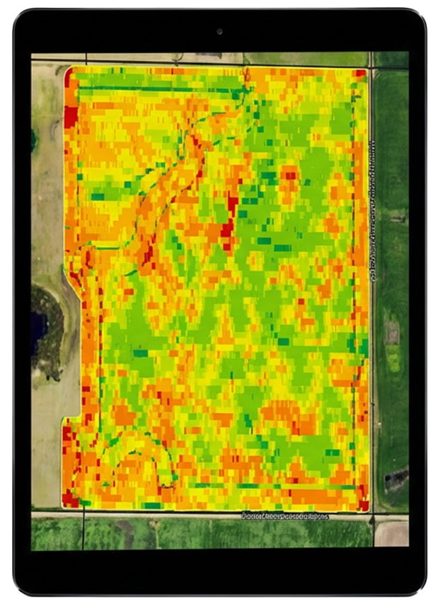
- See the tile infrastructure alongside the yield patterns
- Confidently plan improvements with context
Yield Data
- Integrate fields and yield data from John Deere [Case & Climate coming soon]
- Multi-year yield integration
- Auto-refresh after harvest
- Layer comparison with soil, topography, drainage, tile, and field boundaries
- Detect low-performing zones at a glance
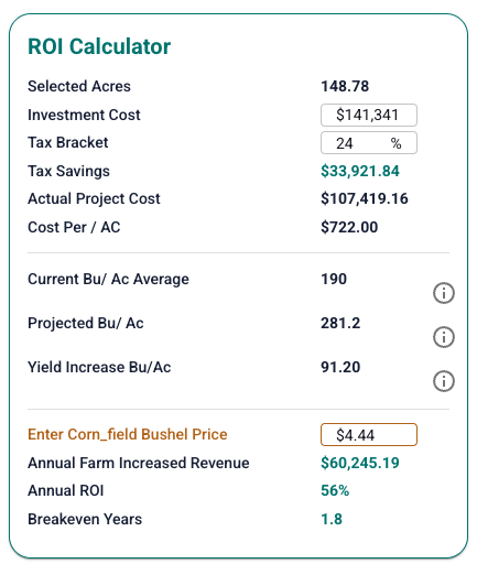
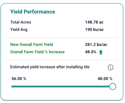
- Quantify the ROI of potential tiling improvements using real crop data
Yield data becomes a decision engine instead of a spreadsheet.
Precision Tile Analysis
TerrainIQ’s Tile Drainage Index (TDI) and precision tile tools help you compare fields, spot water-limited acres, and predict tile ROI with your real yield data.
- See a field’s drainage potential
- Evaluate the tiling impact on low-yield zones
- Compare tiling ROI across different farms
- Build land improvement plans rooted in real data
Portfolio Management
Portfolio Tools
- Rank, sort, and compare fields by average yield, crop type, seed variety, and TDI
- Compare fields year-over-year
- View average county yield for context
- Filter by crop, size, drainage potential, and more
When you manage multiple fields, TerrainIQ makes it easy to see what’s working, and what needs attention.
Reporting
Generate crystal-clear land reports in seconds.
TerrainIQ offers two tiers of reporting, built for different types of decisions.
Land Insights Report
Features include:
- Plat, topo, soil, horizon, drainage, wetland layers
- Tile map (if available)
Yield Performance Report
Built for farmers and land managers using TerrainIQ Water, this report includes everything in the Land Insights Report PLUS:
- Yield analysis (whole field or low-performing areas)
- Precision Tile Analysis and TDI
- County average yield data
- Estimated ROI from tiling
Access TerrainIQ Anywhere
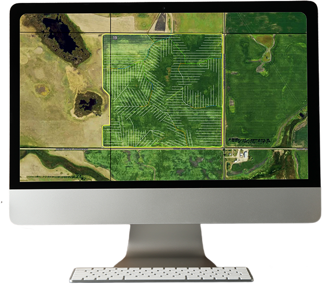
Whether you're at your desk, in the truck, or walking a field, TerrainIQ goes with you.
Windows & Apple
iPad

iPhone
Start Your Free Trial
See your land differently – and make smarter decisions, faster.